Under National Adaptation Fund for Climate Change (NAFCC) in Himachal Pradesh

Climate smart package of practices

Water Harvesting Structures Creation 

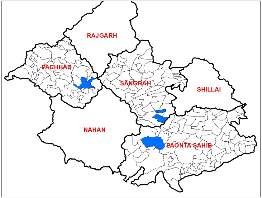
Water harvesting structure in areas of derelict stream to cover the most vulnerable areas of the three developmental blocks Sangrah, Pachhad and Paonta Sahib in the Sirmaur district. Under this activity Lift Irrigation Schemes are being constructed and Micro Irrigation Schemes, Water Channels  are being constructed. The objectives of this activity is to provide water to climatically vulnerable are of the village. 

Lift Irrigation Schemes

1. Lift Irrigation Scheme/Facility: Village Charna Devliya, G.P. Bhat Garh, Block Sangrah

This facility has been developed in Village Charna Devliya, G.P. Bhat Garh, Block Sangrah of district Sirmaur. The salient feature of the facility are:

  • Total C.C.A. covered: 62.32 hect.
  • Family benefited: 10 Nos
  • Area of s/c families to be irrigated: 6.21 Hect.
  • Discharge :76.00 LPS
  • Sump well capacity:  76000.00 Ltr. 
  • Benefit Cost Ratio: 4.31:1
 

2. Lift Irrigation Scheme/Facility: Village Oder Pudla, G.P. Dinger Kinger, Block  Pachhad

This facility has been developed in Village Oder Pudla, G.P. Dinger Kinger, Block  Pachhad of district Sirmaur. The salient feature of the facility are:

  • Total C.C.A. covered: Phase 1st odder -14.75 hect. Phase 2nd odder – 5.50 hect.
  • Families benefited: Odder – 4No Pudla – 8 No
  • Area of s/c families to be irrigated: Odder – 3.60 hect. Pudla – 1.90 hect.
  • Discharge :32.60 LPS
  • Sump well capacity: 113000 L                            
  • Benefit Cost Ratio: 2.54:1
 
 3. Lift Irrigation Scheme/Facility : Village Barotiwala Bhodhwara, Khajurwala, G.P. Parduni, Block Paonta Sahib.
 

This facility has been developed in Village Barotiwala Bhodhwara, Khajurwala, G.P. Parduni, Block Paonta Sahib of district Sirmaur. The salient feature of the facility are:

  • Total C.C.A. covered: 70.50 hect.
  • Families benefited: 28 Nos
  • Area of s/c families to be irrigated: 2.88 Hect.
  • Discharge :42.30 LPS
  • Sump well capacity: 58,000 Litr
  • Benefit Cost Ratio: 1.62:1

Lift Irrigation Scheme - Field Photographs

Micro Irrigation schemes

# BLOCK SCHEME VILLAGE PANCHAYAT LAT LONG
1 Pachhad Kuhal Sehnav Danda 30.32’41” 7742’37”
2 Kuhal Keiry(KOT) Lana baka 30.41’55” 77.17’47”
3 Kuhal Dhar Dhar Tikkri 30.44’584″ 77.11’834″
4 Kuhal(200Mtr.) Nol Dhar Tikkri 30.7002777780 77.2361111110
5 Kuhal(500 Mtr.) Kot Dhar Tikkri 30.7288888890 77.2419444440
6 Kuhal(500 Mtr.) Salena Dhar Tikkri 30.7061111110 77.1930555560
7 Kuhal(500 Mtr.) Jaganji ki sher Sirmori Mandir 30.7311111110 77.2286111110
8 Kuhal(500 Mtr.) Kalser at Kurlu Bajga 30.5894444440 77.2388888890
9 Kuhal(500 Mtr.) Nawda Bagthan 30.5911111110 77.2061111110
10 MIS Keiry BanahDhinni 30.7175000000 77.2361111110
11 MIS Kot(Salena) DharTikkri 30.7066666670 77.1936111110
12 MIS Mandi BanahDhinni 30.7080555560 77.2363888890
13 MIS Gundal Bagthan 30.6675000000 77.2655555560
14 MIS Kolodia Dhar Tikkri 30.7300000000 77.2502777780
15 MIS Kalser(Kayartoo) Bajga 30.5394444440 77.2052777780
16 MIS Tindu Tikkri Kuthar 30.7666666670 77.0541666670
17 MIS Keiry(KOT) Lena Baka 30.68694 77.21389
18 MIS Dhar Dhar Tikkri 30.7504 77.22944
19 MIS Samlesh Jaihar 30.71556 77.19278
20 MIS Madhanikar Jaihar 30,44’56.58″ 077,13’48.78″
21 MIS Jagangi Ki Ser Sirmori Mandir 30.43’52” 077.13’42”
22 MIS Changer Tikkri Kuthar 30.7683333330 77.0508333330
23 Village Pond Keri Bagthan 30.7922222220 77.2388888890
24 Village Pond Johri BanahDhinni 30.33’14” 77.17’15”
25 Village Pond Bauntu Sirmori Mandir 30.43’153″ 77.13’348″
26 Village Pond Shampur Bajga 30.38,50″ 77.15’0″
27 Village Pond Basahan Lana-baka 30.41’23” 77.12’45”
28 Village Pond Shirth BanahDhinni 30.41’39” 77.13’33”
29 Village Pond Dali ka ghat Dhar-Tikkri 30.44’31” 77.13’54”
30 Village Pond Tindu Tikkri Kuthar 30.46’1″ 77.3’12”
31 Village Pond Jagangi Ki Ser Sirmori Mandir 30.44’3″ 77.13’22”
32 Paonta Sahib Kuhal Lambdandi Amboya 30.31’39.8″ 77.43’46.0″
33 Kuhal Kangra Rajpur 30.32’29” 77.44’16”
34 Kuhal Kirog Danda 30.32’52” 77.42’56”
35 Kuhal(200 Mtr) Dhigali -2 Rajpur 30.5347222220 77.7305555560
36 Kuhal(300 Mtr.) Kangra Rajpur 30.5455555560 77.7336111110
37 Kuhal(300 Mtr.) Dhigali -1 Rajpur 30.5397222220 77.7355555560
38 Kuhal(400 Mtr.) Biyasli Nagheta 30.5316666670 77.7566666670
39 Kuhal(400 Mtr.) Adwar Danda 30.32’53.0″ 77.42’55.80″
40 Kuhal(500 Mtr) Kerka Nagheta 30.5216666670 77.7600000000
41 Kuhal(500 Mtr.) Rajpur Rajpur 30.5444444440 77.7338888890
42 MIS Kerka Nagheta 30.32’1″ 77.45’44”
43 MIS Amboya Amboya 30.5386111110 77.7227777780
44 MIS Dhigali Rajpur 30.5397222220 77.7355555560
45 MIS Rajpur Rajpur 30.5452777780 77.7338888890
46 MIS Kirog Danda 30.32’53” 77.42’59”
47 MIS Lambdandi Amboya 30.32’24.7 077.43’54.5″
48 MIS Dhandla Nagheta 30.31’54” 77.45’23”
49 MIS Kangra Rajpur 30.32’48.6″ 77.43’46.5″
50 Village Pond Ram Nagar Amboya 30.5288888890 77.7277777780
51 Village Pond Dhigali Rajpur 30.5288888890 77.7277777780
52 Village Pond Mehruwala Nagheta 30.30’50” 77.44’49”
53 Sangrah Kuhal Palar Lana Palar 30.7177944440 77.4197333330
54 Kuhal Jawal Koti-Dhiman 30.38’8″ 77.32’26”
55 Kuhal Siyarli Jarag 30.39’00.8″ 77.28’18.1″
56 Kuhal Jhajla Danda 30.31’40” 77.45’9″
57 MIS Jamal Gawahi 30.7197333330 77.3483444440
58 MIS Tikker Shamra 30.7611194440 77.4080611110
59 MIS Mandbag Jarag 30.6333638890 77.4501305560
60 MIS Mandbag Jarag 30.6334500000 77.4501055560
61 MIS Gidga (Chinar) BhattanBhajond 30.7167416670 77.3833750000
62 MIS Panjah Gawahi 30.7175055560 77.3669666670
63 MIS Beski BhattanBhajond 30.7122472220 77.4022222220
64 MIS Dungi Lana Palar 30.7122222220 77.4288888890
65 MIS Kashlog Ludhiana 30.7230555560 77.4508333330
66 MIS Dharla Ganog 30.6833333330 77.4836111110
67 MIS Gatlog BhattanBhajond 30,38’24.1″ 077.27’50.6″
68 MIS Siyarli Jarag 30.38’46.4″ 077.28’21.2″
69 MIS Aliyan Bhaghar Jarag 30.38’24.1″ 077.27’50.6″
70 MIS Jaswal Koti-Dhiman 30.38’58” 077.31’3″
71 Village Pond Jamal Gawahi 30.7244666670 77.3361166670
72 Village Pond Runja Gawahi 30.7280750000 77.3333611110
73 Village Pond Kilogdhar Gawahi 30.7275166670 77.3652777780
74 Village Pond Palar Lana Palar 30.7180555560 77.4175000000
75 Village Pond Garari Shamra 30.43’53” 77.24’47”
76 Village Pond Ghirga(Dhar) BhattanBhajond 30.43’14” 77.23’12”
77 Village Pond Arlu BhattanBhajond 30.42’17” 77.22’57”

Micro Irrigation Schemes – Field Photographs